Highlights:
- Last week was the wettest week in Delaware since mid-July 2024
- 100% of Delaware has adequate or better soil moisture
- Stream conditions have returned to normal range in northern Delaware
- Groundwater continues to recover, but is the lone drought indicator that’s still below normal right now
- Above normal temperatures and slightly above normal precipitation are expected for the rest of the month of April
Statewide Drought Discussion
Last week was the rainiest week (Tuesday-Monday) the DEOS network has seen since mid-July 2024, with the network receiving an average precipitation total of 1.81”. Looking at the last 30 days, the network average precipitation total is 6.80”, which is well above the normal amount of precipitation we typically see between mid-March and mid-April. Figure 1 shows a map of total precipitation for all DEOS stations between March 15th and April 14th, 2025.
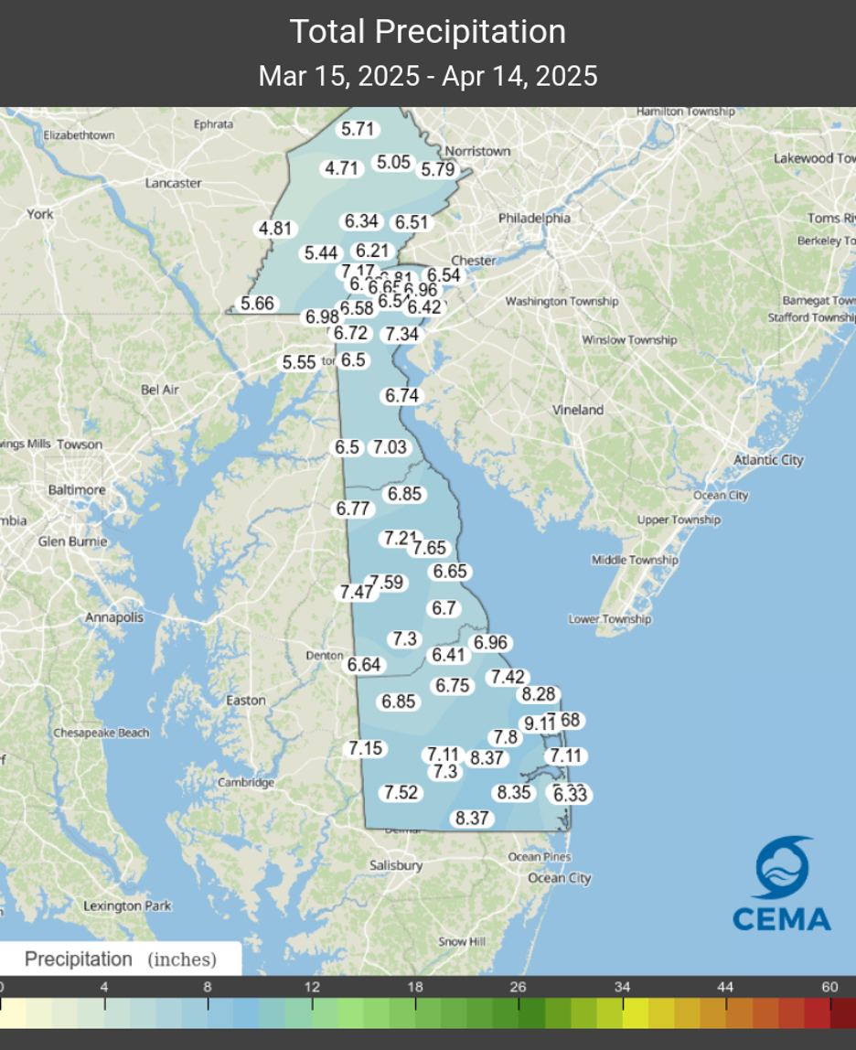
Note that some locations in Sussex County saw over 8 inches of rain, while areas farther north saw slightly less. With above normal precipitation occurring across the whole state, we have seen substantial improvements in soil moisture. Figure 2 shows that most of Delaware is now in the 70th-90th percentile for soil moisture in the top 1 meter of soil.
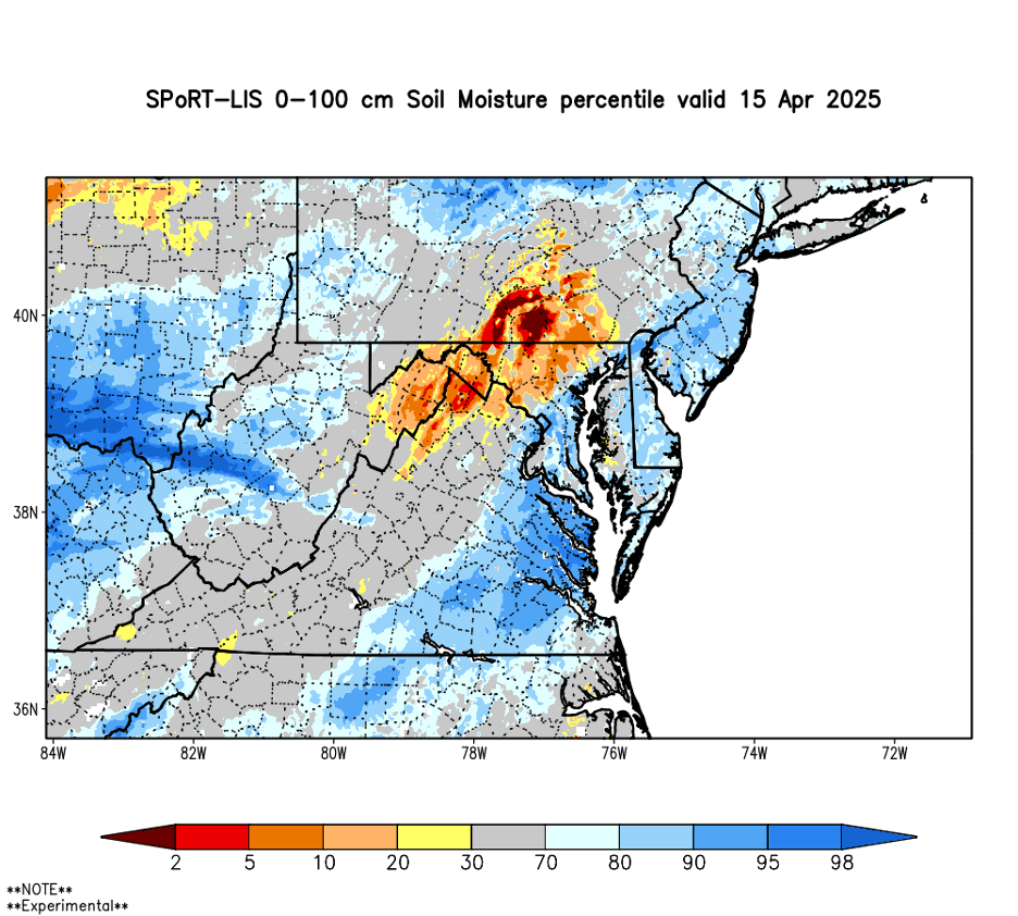
With the growing season just beginning to spin up, the improvement in soil moisture conditions couldn’t happen at a better time.
Stream conditions in New Castle County showed significant improvement resulting in increasing distance away from drought-watch conditions on all three streams monitored for this report (White Clay Creek at Newark, White Clay Creek/Red Clay Creek combined, and the Brandywine Creek at Wilmington). The flows haven’t been at these levels since September 2024. All of the streams are very close to the median flows for this time of year. Streamflows in Kent and Sussex Counties continued to be in the normal to above normal range for this time of year.
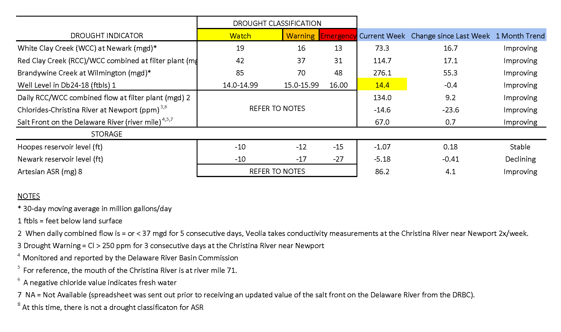
Chloride concentrations in the Christina River near Newport remain well below the first threshold of concern (250 ppm) at -14.96 ppm. The negative value indicates that very fresh water is flowing down the Christina, pushing back any chlorides that may be present. The last time the chloride concentration was above 250 ppm was about six weeks ago during the first week of March (263.2 ppm). In general, chloride conditions have improved throughout the first week of April as precipitation conditions have improved.
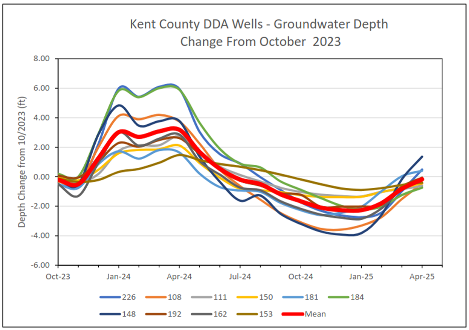
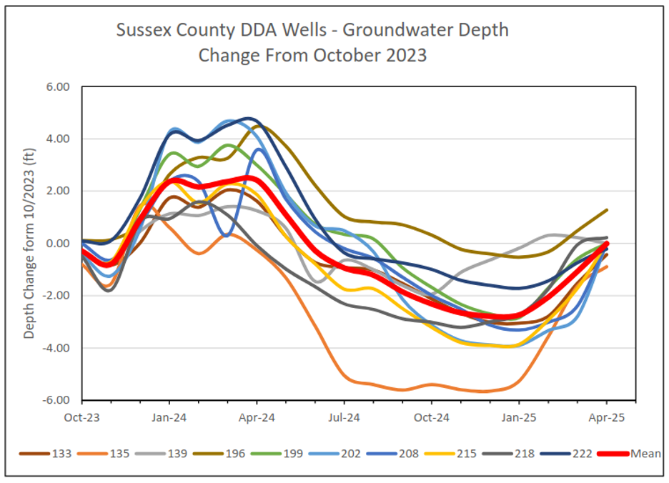
Groundwater conditions are getting much closer to being normal for the time of year, statewide. The water level in well Db24-18 (located just south of Newark) has increased to 14.4 ft below land surface (Table 1). It is slowly starting to recharge, and is now solidly in Drought Watch (14.0 to 14.99 ft below land surface). The water level in this well typically ranges between 9.7 and 13.3 feet below land surface during April. A network of wells monitored by the Delaware Department of Agriculture (DDA) and DNREC are showing major signs of improvement in Kent and Sussex Counties (Figures 3 & 4). The mean depth to water value in these wells have both increased 2 to 2.5 feet over the last few months.
Weather and Climate Outlook:
Above normal temperatures and slightly above normal precipitation are expected for the remainder of April according to the outlook from NOAA’s Climate Prediction Center. This should continue to help with drought recovery. As we go further into the growing season, we’ll be monitoring evapotranspiration conditions very closely, as that will affect how much precipitation we need in order to avoid going back into a significant drought this summer. Higher temperatures lead to higher evapotranspiration rates from vegetation, so we’ll be watching for signs of much above normal temperatures as we go through the spring.