 Preliminary data indicate that 2011 was a very warm and unusually wet year across Delaware. The 2011 mean annual temperature of 58.2 degrees Fahrenheit was 2.5 degrees above the 1981-2010 normal, making it the warmest year since records began in 1895.

 The statewide annual precipitation average of 50.14” was 4.28” above the 1981-2010 normal, making 2011 the 20th wettest year in the last 117.
Precipitation varied significantly across the State with many areas in the northern portion of Delaware experiencing one of their wettest years on record, while some areas in southern Delaware were dryer than normal.
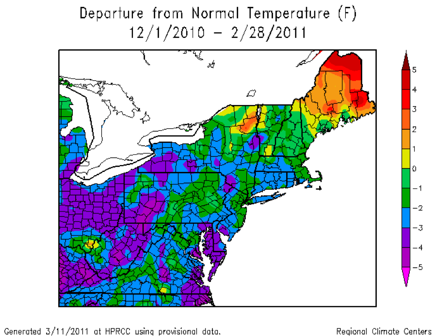
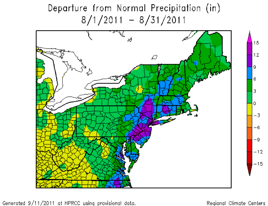
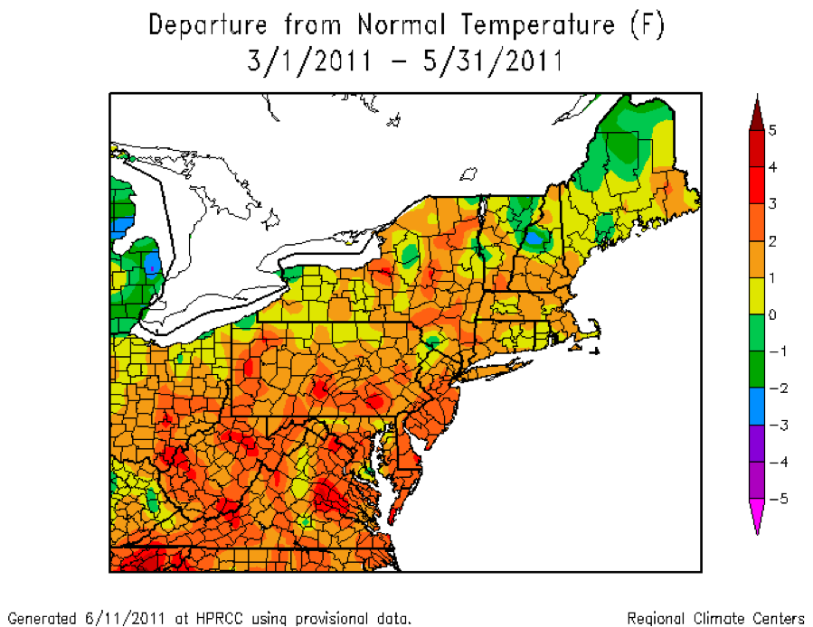
After a colder than normal winter season to start the year, the spring, summer and autumn seasons were all far above normal (see maps at left), contributing to the year’s record warmth across the First State. Excessive precipitation from Hurricane Irene in late August (see map) was partially responsible for the higher than normal annual precipitation totals.
Credit: Maps from Northeast Regional Climate Center, Cornell University
Similar Posts
Climate Office Partners


