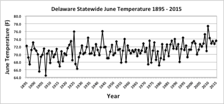
June Temperatures
Preliminary data indicates that the statewide average temperature in June was 73.6°F; this was 1.5°F above the 1981-2010 normal of 72.1°F (Figure 1), making June 2015 the 10th warmest on record since 1895. This is the sixth year in a row that June temperatures have been above normal.
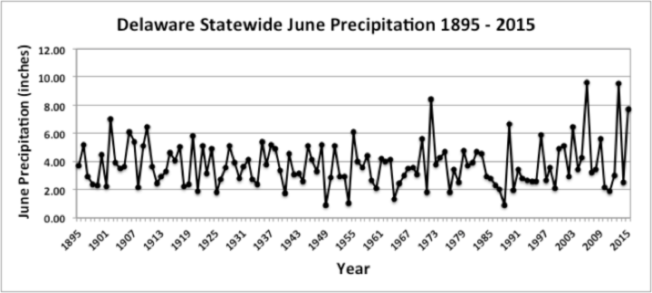
June Precipitation
Delaware’s statewide precipitation for June 2015 averaged 7.71 inches, 3.98 inches above the 1981-2010 mean (Figure 2). June 2015 ranks as the fourth wettest June since records began in 1895. The large precipitation totals during June 2015 followed the 10th driest May on record in which only 1.47 inches of rain fell across the State.
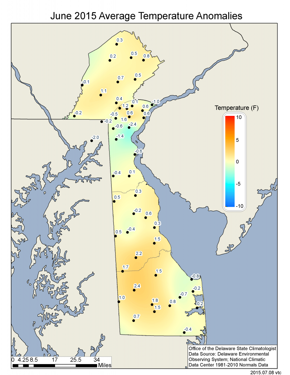
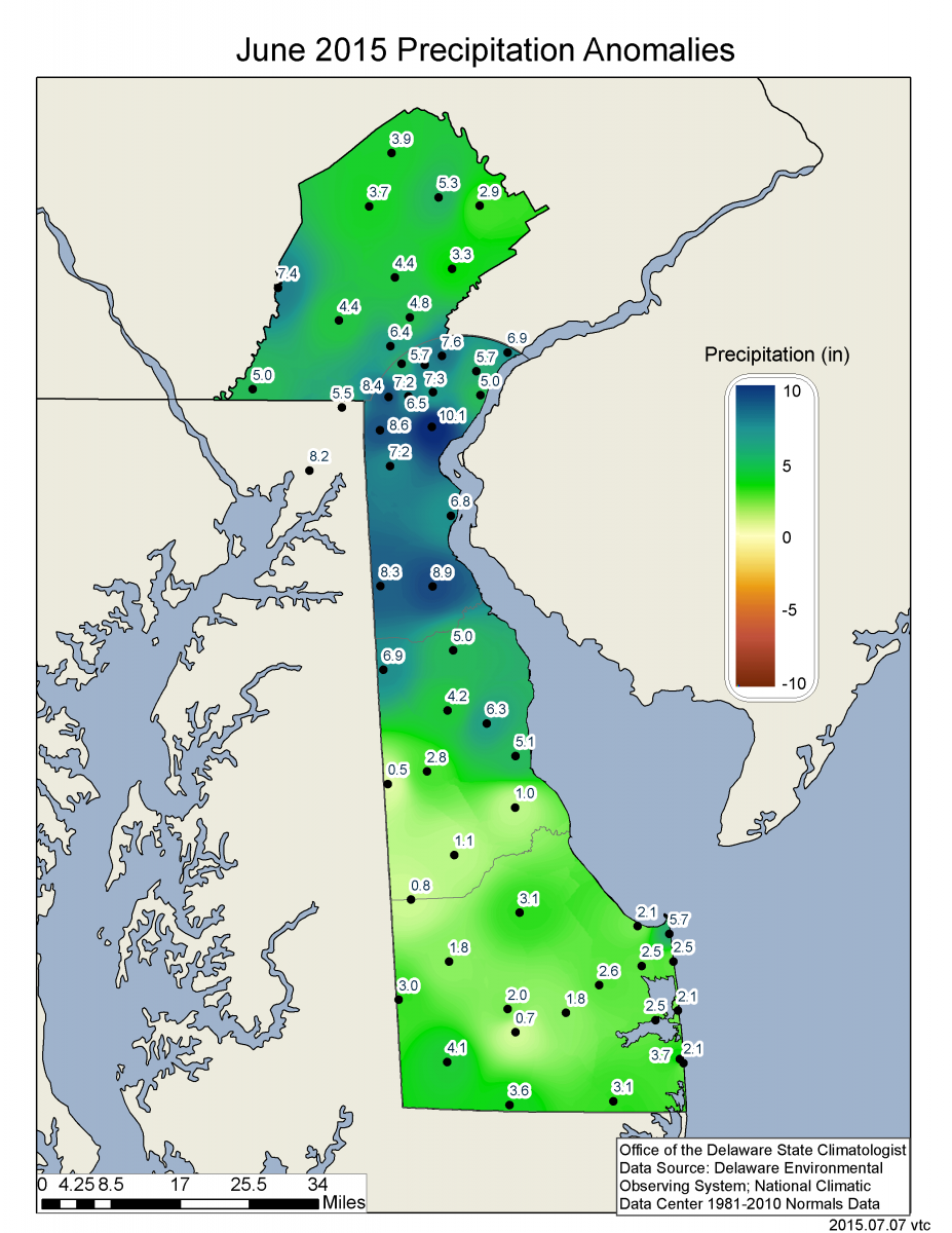
Statewide Spatial Averages
Data from the Delaware Environmental Observing System (DEOS) indicate that most regions of the State experienced temperatures that were above normal during the month, with the largest positive departures found across southern Kent and northern Sussex Counties (Figure 3). Precipitation was much above normal at all locations across the State with positive departures of between five and ten inches found across New Castle County (Figure 4). The smallest rainfall totals were found across Sussex County.
Similar Posts
- June 2026 – Warm and Dry Across Delaware (2026)
- June 2025 – Very Warm with Below Normal Precipitation Across Delaware (2025)
- June 2024 – Continued Warm with Near Normal Precipitation (2024)
- June 2023 – Cool with Variable Precipitation Across Delaware (2023)
- June 2022 – Near Normal Temperature and Precipitation Across Delaware (2022)
Climate Office Partners


