September Temperatures
Preliminary data indicates that the statewide average temperature in September was 72.1°F, 4.1°F above the 1981-2010 normal of 68.0°F (Figure 1). September 2015 was the warmest since 1961 and tied with 1961 as the 3rd warmest since records began in 1895.
September Precipitation
Delaware’s preliminary statewide precipitation total for September 2015 averaged 3.21 inches, 0.76 inches below the 1981-2010 mean (Figure 2). 2015 was the 4th September in a row with below normal rainfall across Delaware.
Statewide Spatial Averages
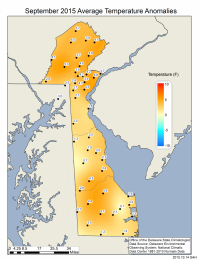
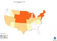
All stations across the Delaware Environmental Observing System (DEOS) network experienced higher than normal temperatures during September (Figure 3). Temperature anomalies reached as high as 5.3°F, with the largest departures generally found across northern Delaware and Chester County, PA. Delaware was not the only state that experienced a warm September, as 45 of the 48 coterminous states had above normal temperatures during the month (Figure 4).
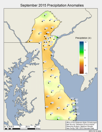
Precipitation was generally below normal across the entire State, with the largest negative departures found across northern and central Sussex County (Figure 5).
Similar Posts
- September 2025 – Warm with Below Normal Precipitation Across Delaware (2025)
- September 2024 – Very Dry with Near Normal Temperatures (2024)
- September 2023 – Warm with Above Normal Precipitation Across Delaware (2023)
- September 2022 – Near Normal Temperatures and Dry Conditions Across Delaware (2022)
- September 2021 – Warm with Near Normal Precipitation Across Delaware (2021)


