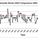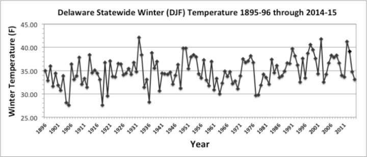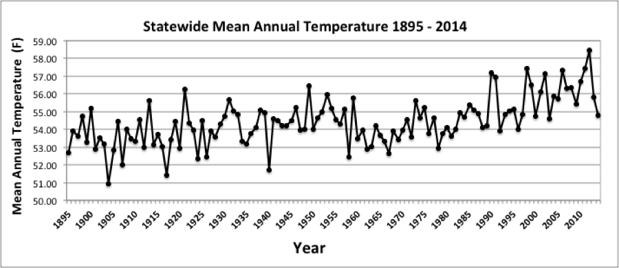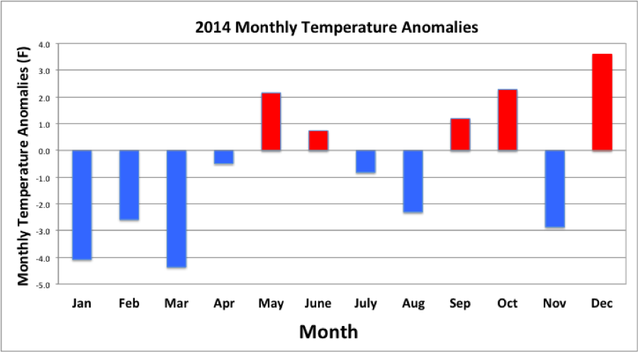
January Temperatures
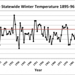
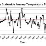
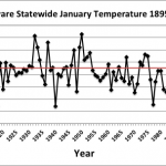
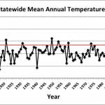
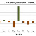
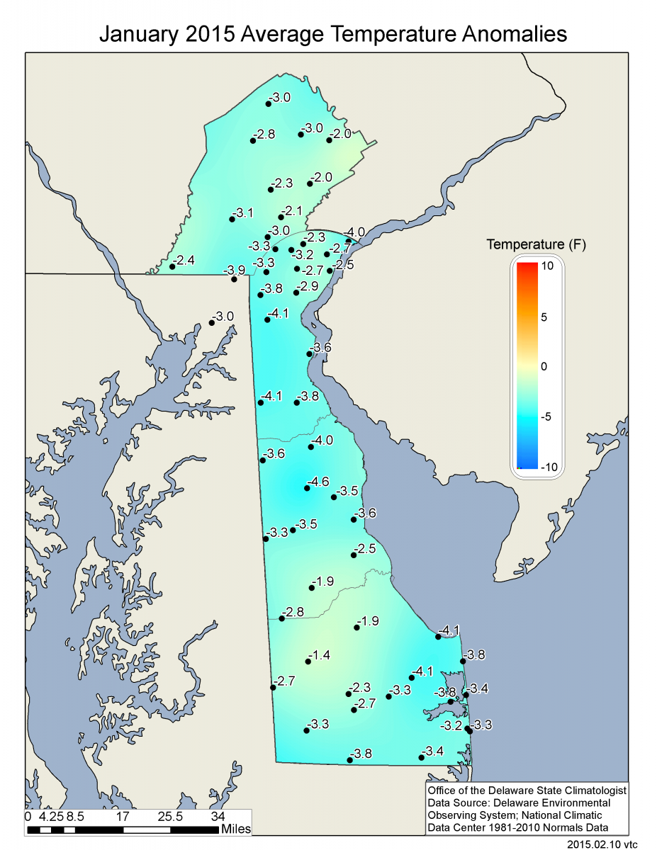
Preliminary data indicates that the statewide average temperature in January was 32.6°F, which is 1.5°F below the 1981-2010 mean value of 34.1°F (Figure 1). This was the third month in a row with
temperatures at or below normal across Delaware. Most of the United States east of the Rocky Mountains shared in Delaware’s colder than normal January temperatures (Figure 2).
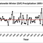
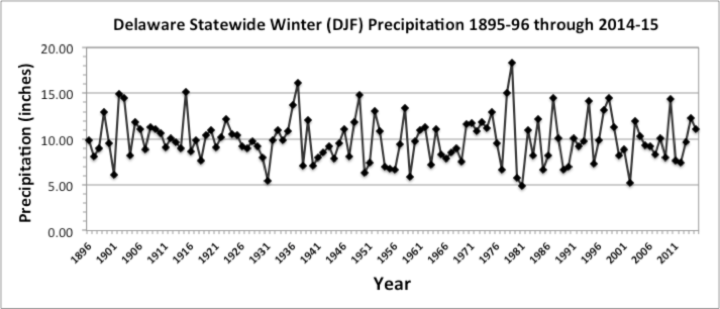
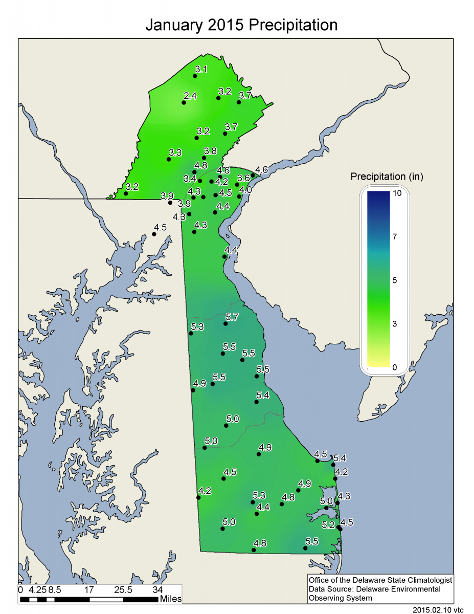
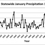
January Precipitation
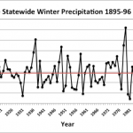
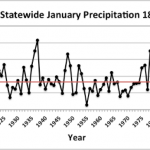
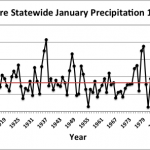
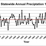
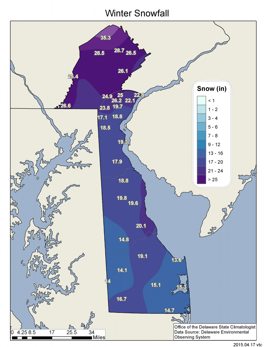
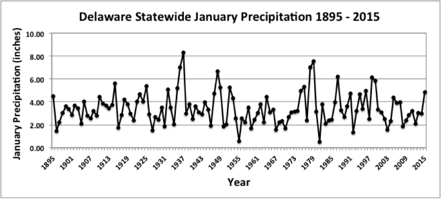
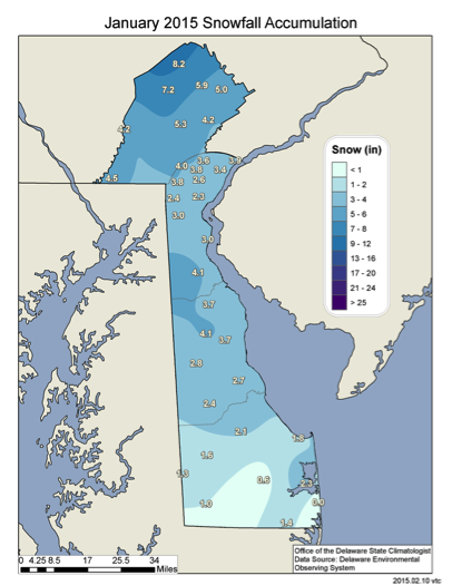
Delaware’s statewide precipitation for January 2018 averaged 2.97 inches, 0.35 inches below the 1981-2010 mean (Figure 3). Snowfall was also below normal during the month in northern Delaware with
only 3.5 inches of snow recorded at the Wilmington – New Castle County Airport . However, a storm on January 4th brought heavy snowfall to Sussex County, with many locations receiving more than
10 inches of snow.
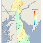
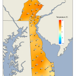
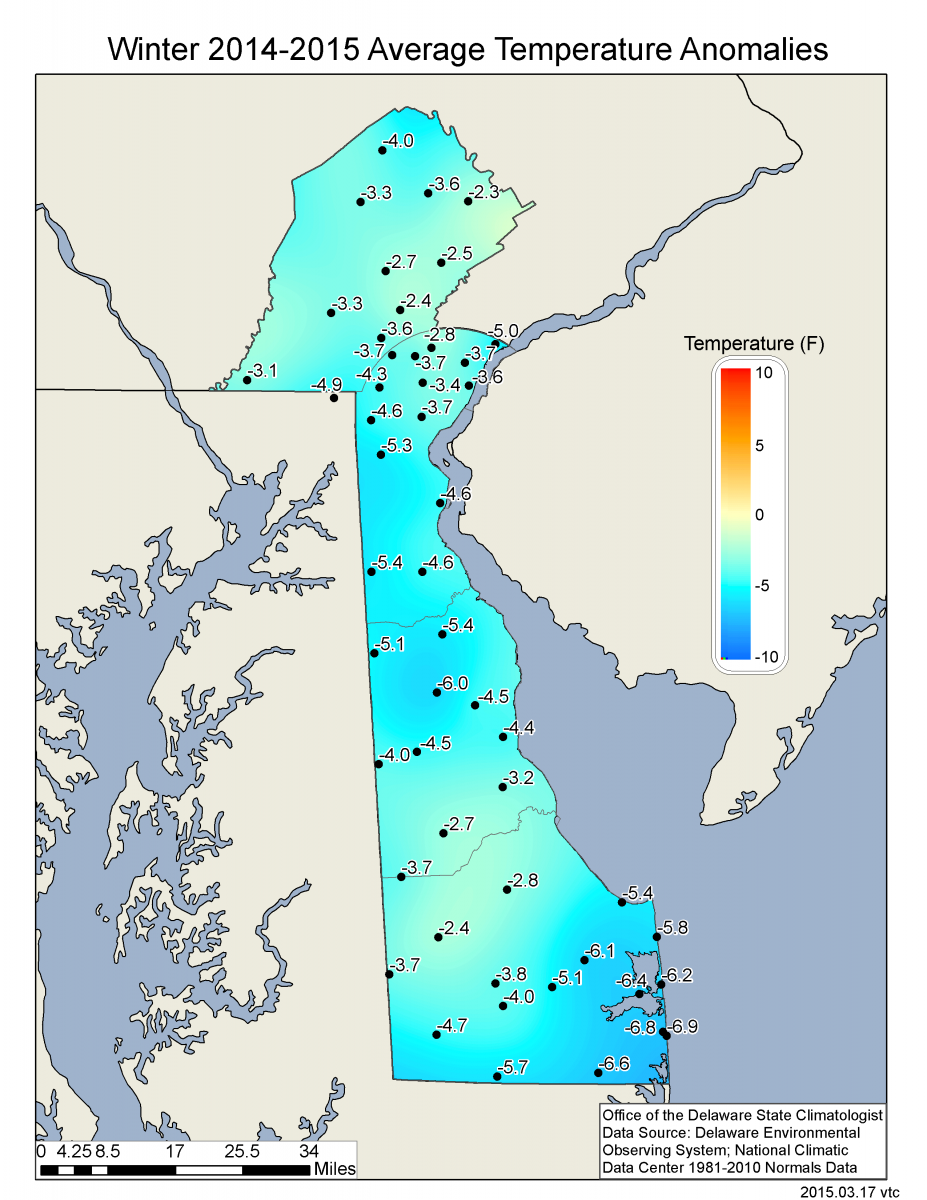
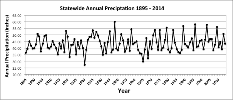
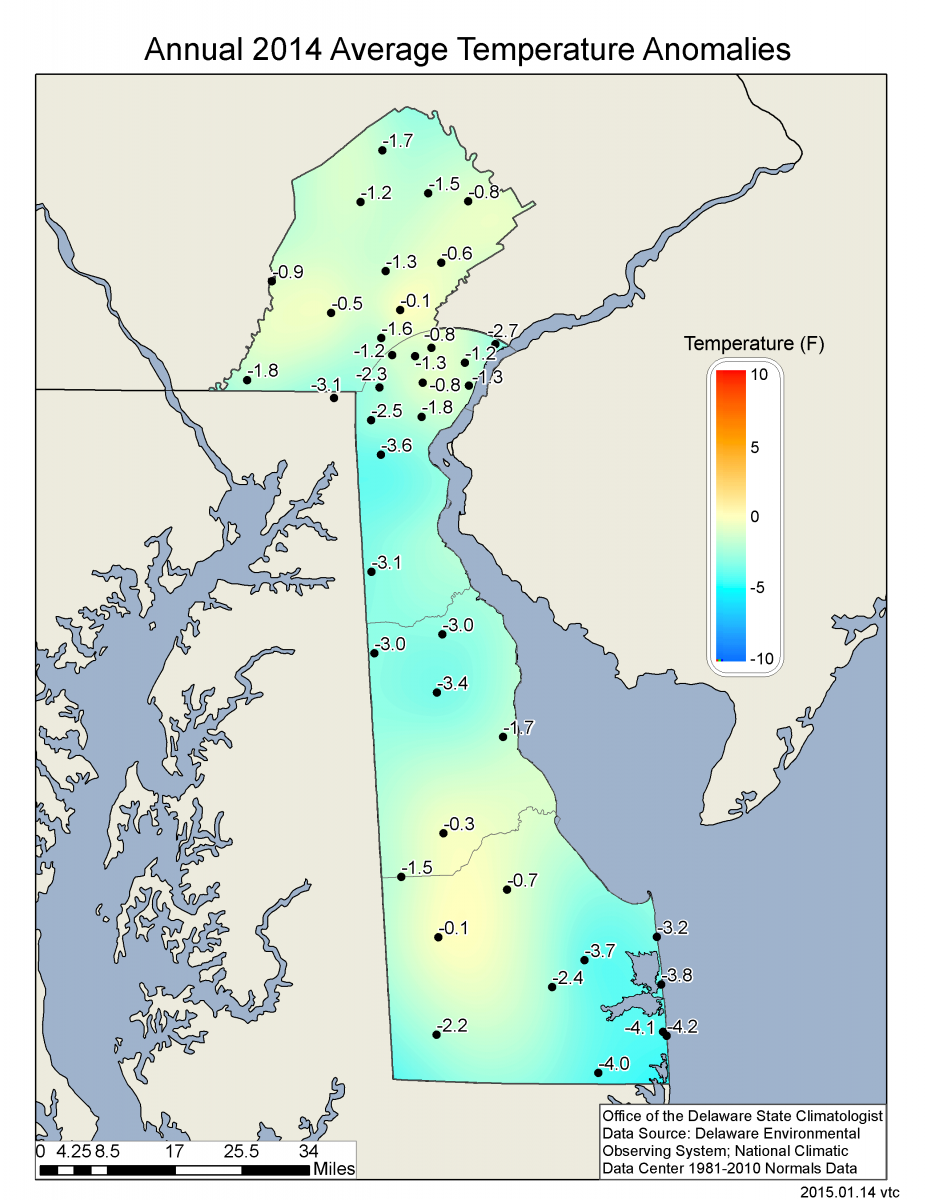
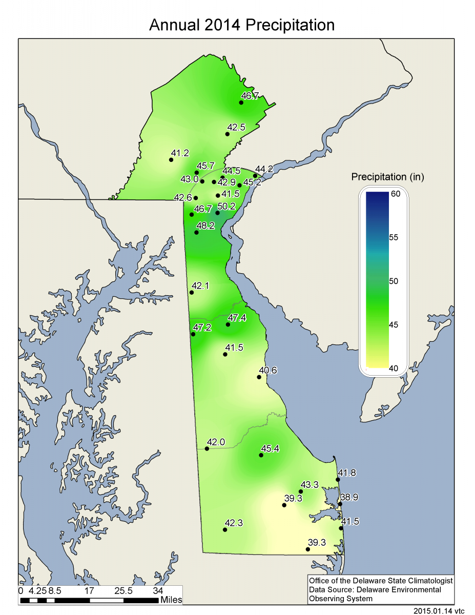
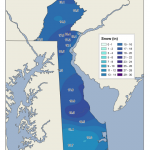
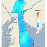
Statewide Spatial Averages
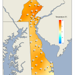
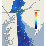
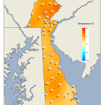
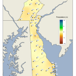
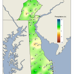
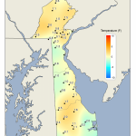
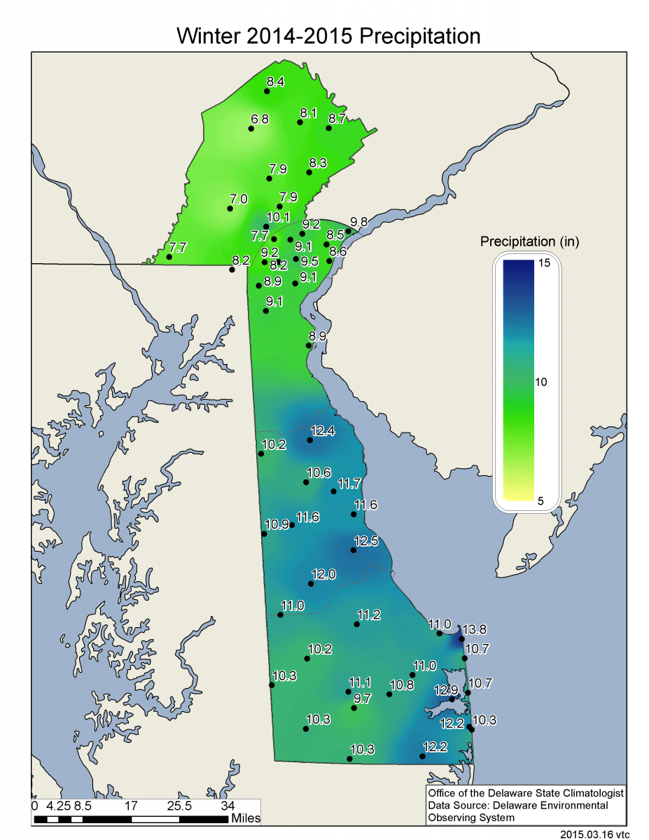
Data from the Delaware Environmental Observing System (DEOS) show that temperature departures were uniformly below normal across the entire State (Figure 4). Precipitation departures were
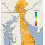
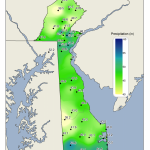
below normal at all but a few scattered stations (Figure 5), with most stations seeing departures of 1 inch or less.
-
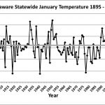
- Figure 1. Delaware statewide mean January temperature (°F) 1895-2018. Light gray line indicates 1981-2010 normal.
-
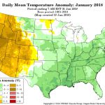
- Figure 2. National daily mean temperature anomalies for January 2018 (from the PRISM Climate Group, OSU).
-
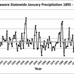
- Figure 3. Delaware statewide January precipitation (inches) 1895-2018. Light gray line indicates 1981-2010 normal.
-
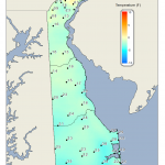
- Figure 4. January 2018 average temperature departures (°F) from the 1981-2010 mean based upon DEOS station data.
-
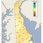
- Figure 5. January 2018 precipitation departures (inches) from the 1981-2010 mean based upon DEOS station data.